Navionics+ NSEU644L Baltic Sea (microSD/SD)
Garmin Navionics+ NSEU644L Baltic Sea charts on a microSD/SD card for Garmin…
In stock — ready to ship
- Venipak delivery in 1–3 business days
- Collect at our showroom in Vilnius
- 14-day returns for unused goods
- Advice and installation in our own service centre
SKU: 010-C1273-20
What matters most in this model.
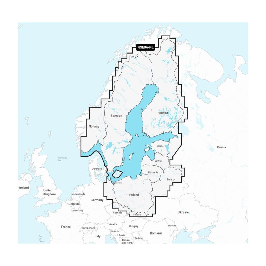
Garmin Navionics+ NSEU644L Baltic Sea charts on a microSD/SD card for Garmin chartplotters. Includes coastal and inland water cartography, Auto Guidance+ and a 1-year subscription to daily updates via ActiveCaptain.
Garmin Navionics+ NSEU644L – electronic charts of the entire Baltic Sea region on a microSD card with an SD adapter, designed for Garmin chartplotters.
- Coverage: Baltic Sea coastal and inland waters, the Gulf of Bothnia, the Gulf of Finland and the Gulf of Riga, the Masurian Lakes, the Szczecin Lagoon, Lake Peipus, Vänern, Vättern and other Scandinavian lakes
- Auto Guidance+ route suggestions (for planning only)
- Depth range shading, 0.5 m depth contours, shallow water highlighting
- 1-year subscription to daily updates via ActiveCaptain
Garmin’s list: ECHOMAP UHD, UHD2, Ultra and GPSMAP series; STRIKER is not included.
All the numbers in one place.
Delivery, returns and warranty.
Delivery
Venipak parcel locker or courier across Lithuania, usually in 1–3 business days. You can also collect the order at our showroom in Vilnius.
Returns
Unused goods in original packaging can be returned within 14 days.
Warranty
Manufacturer warranty applies; the exact term depends on the brand and model.
Payment in instalments
ESTO leasing is available for most products — you can calculate the monthly payment before ordering.
Official dealer
Authorised sales and warranty in Lithuania.
Own service centre
Service and parts in Vilnius.
Choose with us
We help you match the model to your boat.
Personal consultation
Advice before and after the purchase.