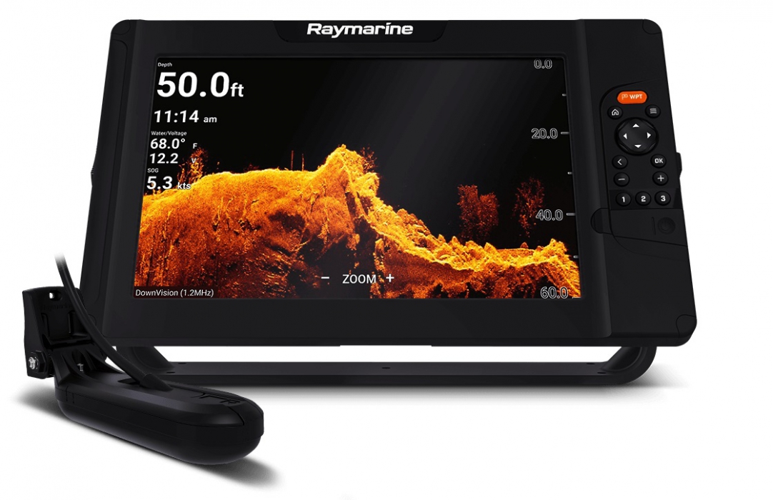
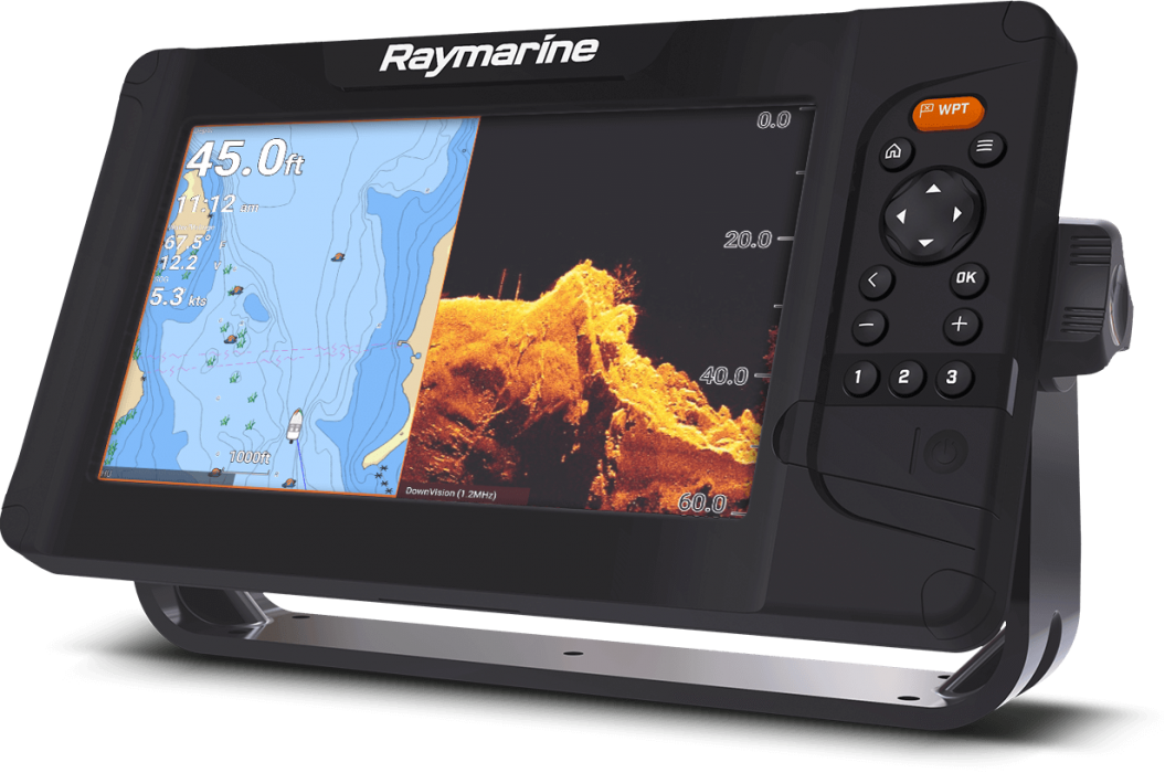
Element 9 Hypervision
Kainos pagal komplektaciją:
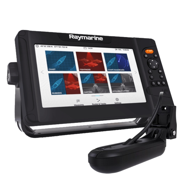
Element 9 HV - 9" Chart Plotter with CHIRP Sonar, HyperVision, Wi-Fi & GPS, BE SPINDUOLIO 1129eur
Element 9 HV - 9" Chart Plotter with CHIRP Sonar, HyperVision, Wi-Fi, GPS, SU SPINDUOLIU 1300eur
Techninė specifikacija
- Display Size: 9.0" Optically Bonded LCD
- Display Resolution: 800 x 480 WVGA
- Display Type: Non-Touch
- Brightness: 1,500 nits
- Viewing Angle: Top 50° / Bottom 60° / Left 70° / Right 70°
- Dimensions: 287 x 161 x 62mm (11.3 x 6.3 x 2.4 inches) | W x H x D
- Product Weight (lbs): 5.0
- Waterproof Rating: IPx6 and IPx7
- Operating Temperature Range: -25°C to + 55°C (-13°F to 131°F)
- Storage temperature range: -30°C to +70°C (-22°F to 158°F)
- Voltage: 12V DC (8V to 16V DC)
- Power Consumption (max 12V DC): 20 Watts
- GNSS / GPS: Built-in GNSS Receiver: GPS/GLONASS- 10Hz
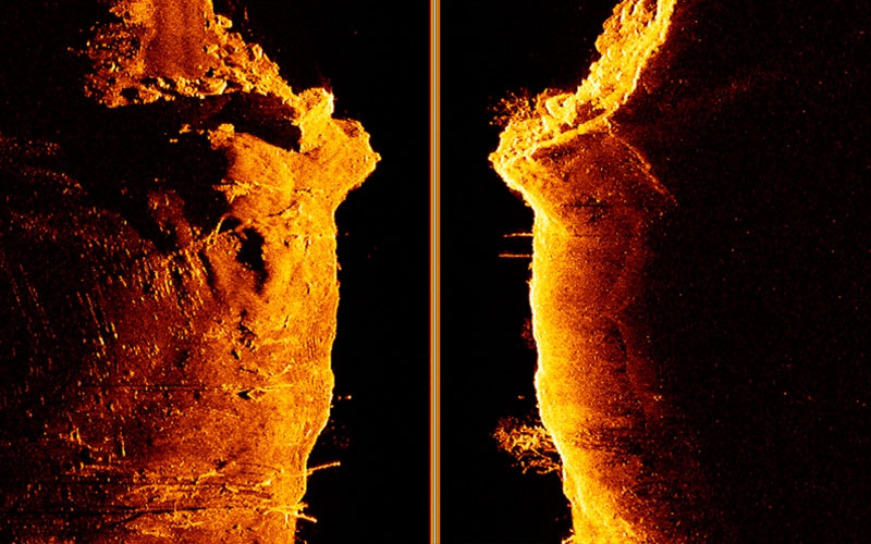
- Sonar Type (Built-in): Built-in CHIRP Sonar | DownVision (Standard and Hyper) | SideVision (Standard and Hyper) | RealVision™ 3D (Standard and Hyper)
- Sonar Connection: 15 pin HyperVision™ type connector
- Sonar Depth: CHIRP Sonar = 274m (900 feet) | DownVision™ Standard = 183m (600 feet) | DownVision™ Hyper = 30m (100 feet) | SideVision™ Standard = 91m (300 feet) | SideVision™ Hyper = 30m (100 feet) | RealVision™ 3D Standard = 91m (300 feet) | RealVision™ 3D Hyper = 30m (100 feet)
- NMEA2000: 1 x NMEA2000 port (DeviceNet microC)
- Supported NMEA2000 Networking: INPUT: NMEA2000 Compatible Engines (Max 2) | NMEA2000 Compatible Tank Sensors (Max 4) | Heading Sensor (for Chart Stabilization) | OUTPUT: GPS (for VHF Distress and DSC)
- SeaTalkng: Requires A06045 DeviceNet female (F) adapter cable - 400mm
- Wi-Fi: WiFi - 802.11 b / g / n
- BlueTooth: Bluetooth 4.0 + Low Energy + Power Class 1.5
- Cartography: Raymarine LightHouse NC2, Navionics, C-MAP Essentials, C-MAP 4D MAX+, and compatible with all charts listed on Raymarine Chart Store.
- Tides & Currents: Requires LightHouse LNC2, Navionics or C-MAP
- Waypoint | Routes | Tracks: 10,000 wpts / 200 wpt groups | 150 rts - 250 wpt max | 16 tracks - 10,000 max trk pts
- Internal Memory: 8GB Solid State
- External Memory: 1 x microSD slots (rear) - microSDHC max 32GB NTFS or FAT32 format / microSDXC max 2TB NTFS or FAT32 format (microSD native format of exFAT must be reformatted to NTFS or FAT32)